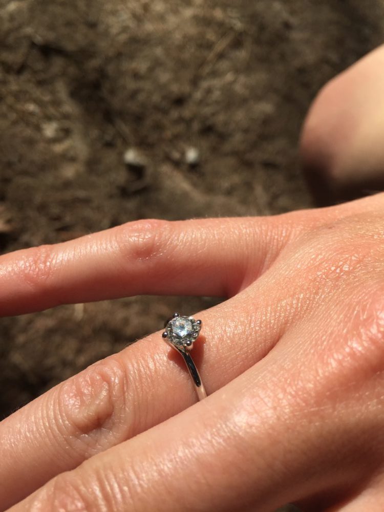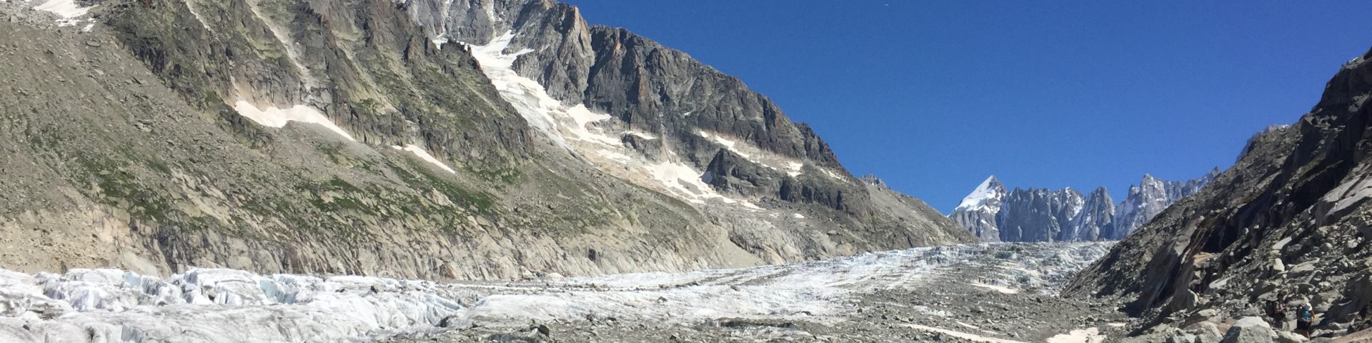
This is a very special hike for us. Not because it offers super beautiful views or you end up walking on a glacier. The reason is that I proposed to my fiancée while on the glacier and she said yes! So this is officially our engagement route. It starts at about 1.2 km above sea level and goes all the way up to 2.3 km without encountering almost any flat bits. And once you gain some altitude you better have a good sun cream on you as there’s hardly any shadow up there.
The hike starts by Camping du Glacier d’Argentière, in the village Les Chosalets, where we were staying. The route then passes by the base station of Les Grands Montets that lazy tourists can use to avoid the steepest part by taking a cable car up to Lognan (1972m), the middle station. Now there’s about 3km of steep ascend ahead of you as you’ll be walking on red ski slope also called Lognan.
Please note, when you look at our route below you can see that in the middle of the red slope our track (the blue line) turns left to the forest as well as carries on straight up along the slope. Turning left to the forest is the correct path (that we unfortunately overlooked and instead walked straight for another 500 m).
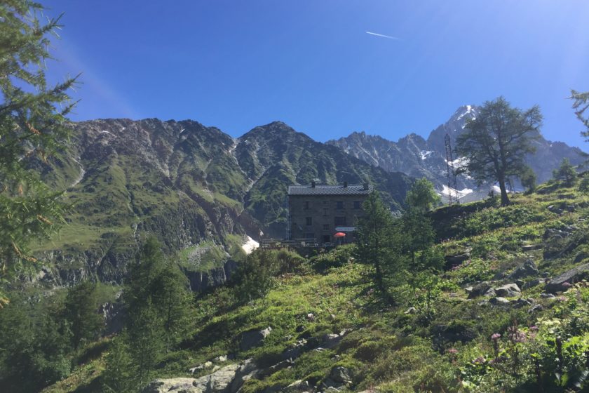
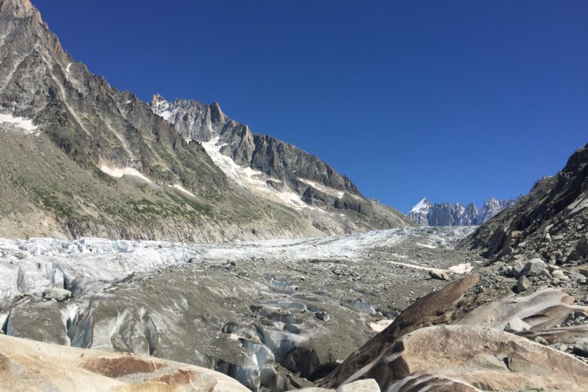
So once you get off the red slope and take the lovely path through the forest you’ll eventually get to Chalet Refuge de Lognan where you can grab a beer or something to eat and enjoy the amazing view of the Argentière Glacier. From there it’s just a short hike to the point where you can access the ice beast and walk on it. If you do it be extremely careful as there are many cracks and I bet it’s not that difficult to slip and disappear in there forever. That’s why most people are usually tied up on the rope when walking on the glacier. Btw. in case you wondered – it was here, right where the track finishes and starts coming back, where I knelt down and asked the question…
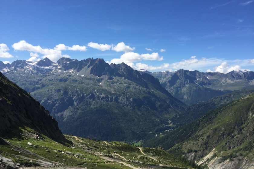
Although there’s almost 9km between you and Les Chosalets it takes less than it seems. From now on you’ll only be descending and if you’re fast enough you might have time to grab a quick drink by the Lognan middle station.
Below the map you can download the route’s GPS coordinates in the GPX format. If you ever get to do this route please let us know your experience in the comments.