If you go to Norway and you’re somewhere nearby Jotunheimen national park this hike is a must then! Rated one of the top 10 hikes in the world by National Geographic, it offers everything you could wish for – challenging terrain, amazing views and almost a 30km long route.
This hike listed in both the Wild Camping and One Day Hiking sections as it’s up to your preference how to approach it. If you manage to get a very early start it can be done in one go but since we only set off in the late afternoon we spiced it up with one night of wild camping.
The most famous part of this track is the bit from Memurubu to Gjendesheim (16.5km) called Besseggen Ridge. But, as well as us, you can do the whole thing by taking the ferry all the way to Gjendebu. Just be aware that the ferry departs only a few times a day and it’s wise to book your space.
If you decide to set off from Gjendebu there’s a very challenging bit almost right at the very beginning of the route, as you’ll have to gain the altitude by defeating the first peak! The climb is less than 2km long but it’s rather steep and several times you’ll be forced to use chains set in the rock to pull yourself up because there’s just nothing else to hold on to to scramble your way up.
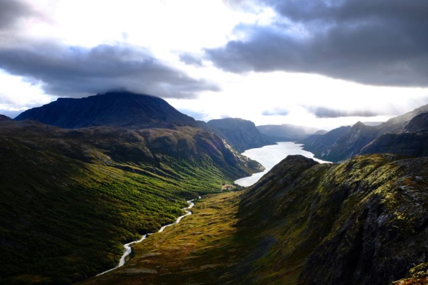
Once you’re up it’s a pretty easy hike all the way to Memurubu. Just follow our GPS track (or the red marks) and enjoy the views – glaciers, lakes, snowy peaks, wild birds,… We decided to pitch our tent at the beginning of the descend to Memurubu because it was getting dark. Usually I highly recommend our camping spots but this time it wasn’t that great as we had to improvise to find some protection from the strong winds coming from the Gjende direction. The view from the spot was stunning (see the pictures below), we were protected from the strongest guts (although there was wind coming from the other side too) but the main problem was that the ground wasn’t really flat. But as an emergency spot it worked well… In case you’re interested it’s exactly the 8.431th km of the route and the coordinates are: N 61°29.0950’ E 008°35.2783’. I guess it may be a better idea to make it all the way to Memurubu where you pitch you tent. But in this case you’ll have to accept the fact you’ll have humans and a bit of civilisation around you.
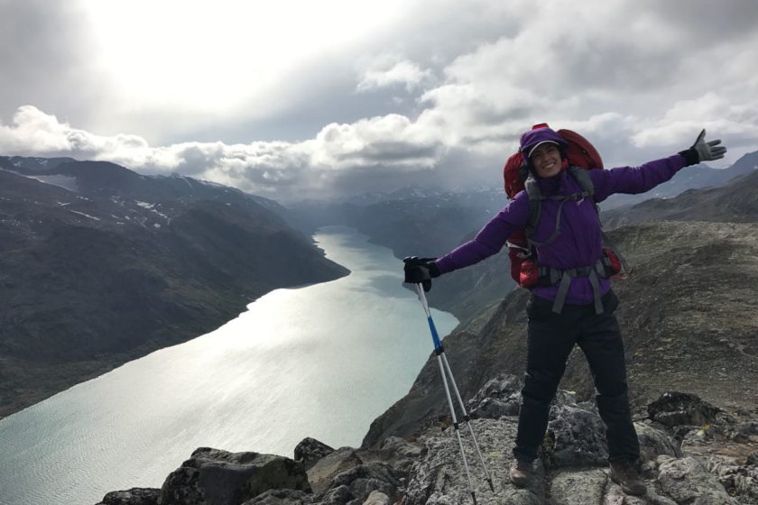
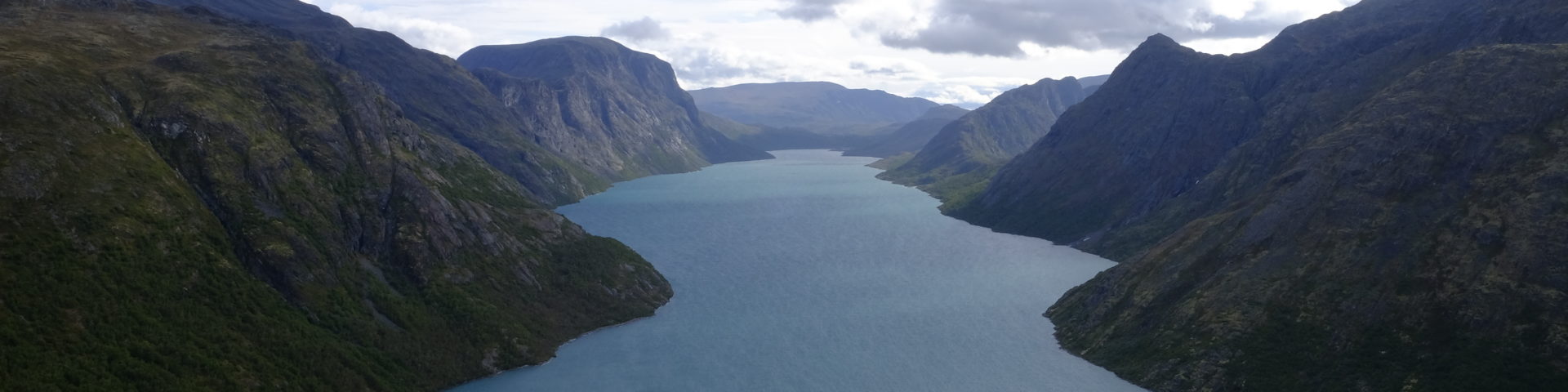
From there it’s only about an hour to Memurubu where the famous Besseggen Ridge starts. Again, there’s a long ascend ahead of you as you need to gain the lost altitude. Once you reach the first peak the trail gets easier and you can fully enjoy one of the best hikes in Norway. With Besshø on your left and Gjende and numerous peaks, waterfalls or glaciers on your right you’ll understand why this hike is so popular. Once you pass by lake Bjønbøltjønne you’ll soon arrive to another lake, Bessvatnet. This is the beginning of a 1.5km long scramble. It’s not difficult but it’s still important to be very careful as one slip can lead to a very nasty injury. The top of the scrambling bit offers a real “viewgasm” and you better enjoy it because the rest of the route is almost viewless and not really that entertaining. You’ll then soon reach the highest peak of the whole trail, Veslfjellet (1743m) and from there it’s about 5.5km back to Gjendesheim.
The last few kilometres get sort of steep and there’s even one or two parts where you have to use the chains again. But all this is a nice distraction from the fact that your car still seems so far away, your energy level is almost depleted and you have to listen to your wife / girlfriend complaining how tired she is… With its length and all the ascends and descends, it is not an easy hike but it’s definitely rewarding and I couldn’t recommend it more!
You can download the GPS coordinates (in GPX) below the map by clicking on “Download”. We really hope you’ve found this post useful and we’ll be happy to hear any feedback through the comment section.