Thinking of wild camping near Scafell Pike? This is an awesome 3 day route that takes you to over 10 Lake District’s peaks including Scafell Pike (978m), Great End or Great Gable. It involves 2 nights of wild camping and the total length is 26.2km. Each day can be easily completed at a relaxed pace.
Day 1 (Bessyboot, Glaramara, Allen Crags)
The route starts in Seathwaite where you can either pay for a private parking or just park on the side of the road. We chose the second option not paying attention to the posters informing about car burglaries happening in this area. Looking back, I guess the burglars must have been on holiday as when we came back to the car in two days’ time we realised I’d had left the driver’s window fully opened. Luckily, it rained only once…
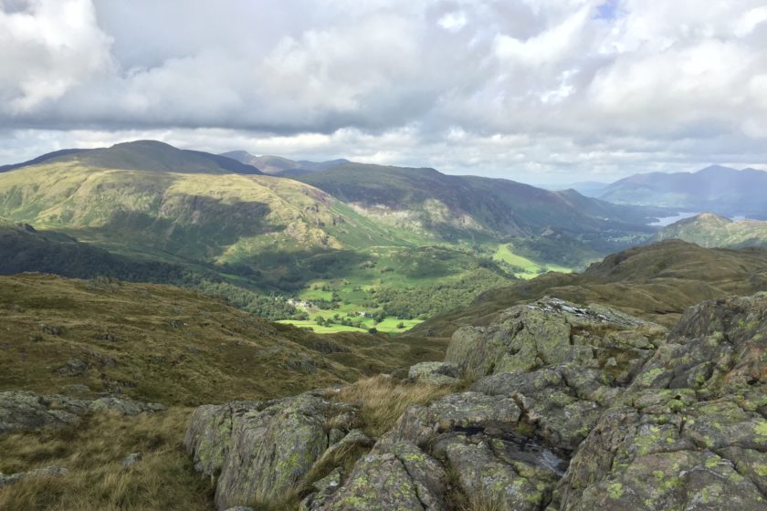
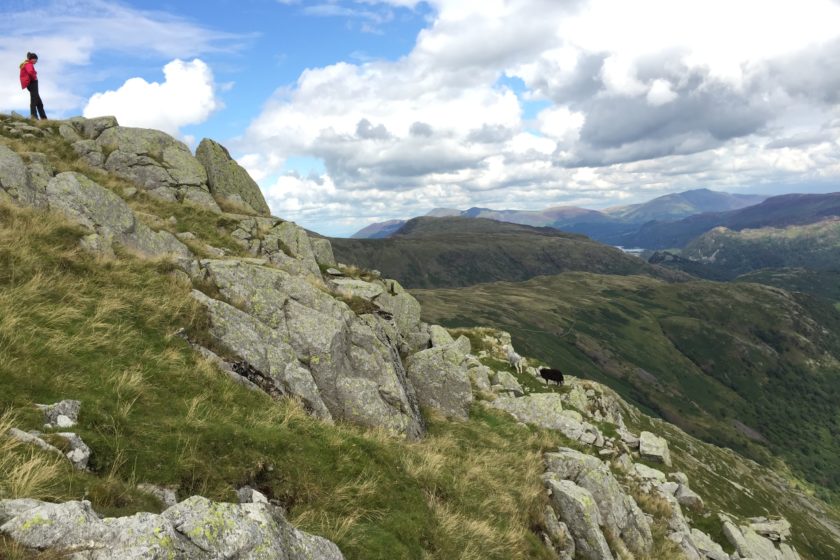
The very first two kilometres are the only bit on the road of the whole adventure. Shortly after you pass by Seatoller you’ll join a footpath that takes you to the bottom of a long and steep climb. When you start ascending towards Tarn at Leaves lake there isn’t really any path to follow so just choose the most comfortable way to get up. Once you defeat your first peak of the trip, Bessyboot (540m), get ready for many more to follow before you start pitching your tent – Rosthwaite Cam (612m), Dovenest Top (623m), Combe Door (676m), Combe Head (735m), Glaramara (783m), Looking Steads (775m), Red Beck (721) and Allen Crags (784m). Just follow the direction of the coordinates and make your way from one peak to another – once you reach one it’s always easy to see the next one.
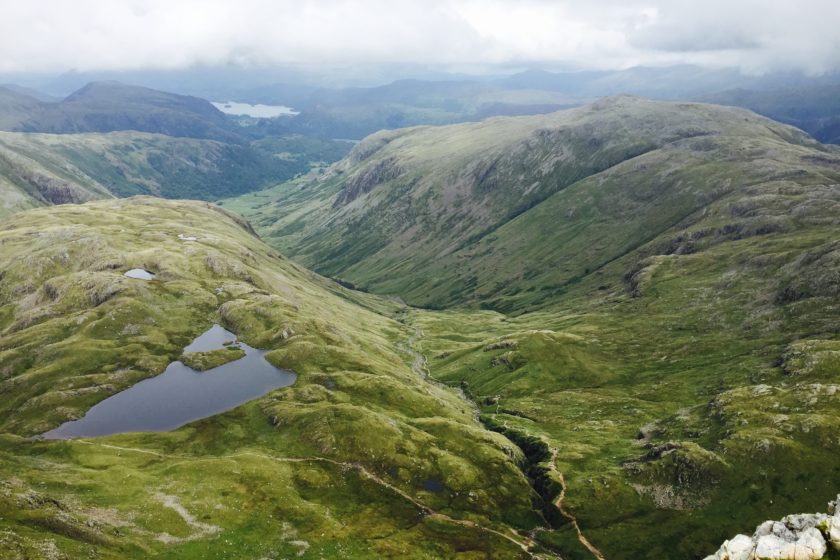
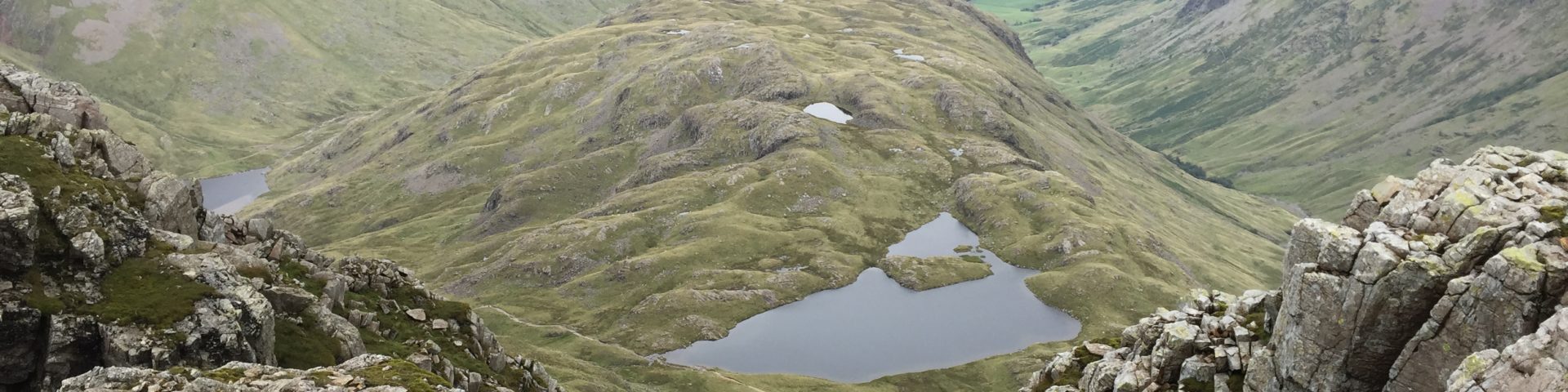
The wild camping spot we found has some really stunning views as well as a clean little river, Ruddy Gill, a few metres away. Since it’s right next to a popular path up to the summit I suggest an early start in the morning to avoid people passing by while you’re having a breakfast. That’s the downside of wild camping near Scafell Pike… Alternatively, you can try to camp by the nearby lake, Sprinkling Tarn, but the ground was too boggy to pitch a tent there when we were there.
Please note that the first day’s GPS track is not 100% accurate and the actual path may be several metres away. It’s still pretty easy to follow the route and the coordinates get more accurate towards the second part of the first day.
Day 2 (Great End, Scafell Pike, Lingmell)
The first steps of the second day will take you back to Esk Hause, which is a four-way cross road. If you want a little detour from the main route follow our GPS coordinates to get to Esk Pike (885m) and back to Esk Hause again. However, feel free to skip this bit and make your way straight to Great End (910m) that offers some amazing views down to the valley.
The very next peak is fun to be climbing to as the last bit is quite steep requires using your hands as well. And once you’re up you’ll be standing in the highest spot in England! Yes, we’re talking about Scafell Pike (978m), which was also my least favourite summit of this whole backpacking adventure due to the amount of people you meet up there. But those who don’t prefer solitude when hiking will surely enjoy it as much as other peaks.
After that you’ll be heading to Lingmell. It’s up to you if you want to follow an easy path from Scafell Pike that you’ll be sharing with other hikers or you follow our route and enjoy a challenging descend. Here, again, the coordinates might not be 100% accurate and the path going down the steep side of the summit may be a few metres on the right or left. Please be careful on your way down as this is not the official and ‘safe’ path and it’s very easy to slip here.
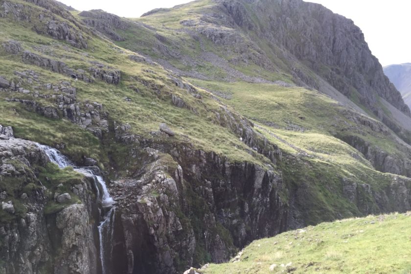
Once you enjoy your last peak of the day, Lingmell (807m), take the Corridor Route for about 1.3km to reach a great camping spot that is just a few steps off the path. It has a little waterfall nearby for clean water, a stone wall to get some wind protection while cooking and most importantly some truly amazing views.
Day 3 (Great Gable, Green Gable)
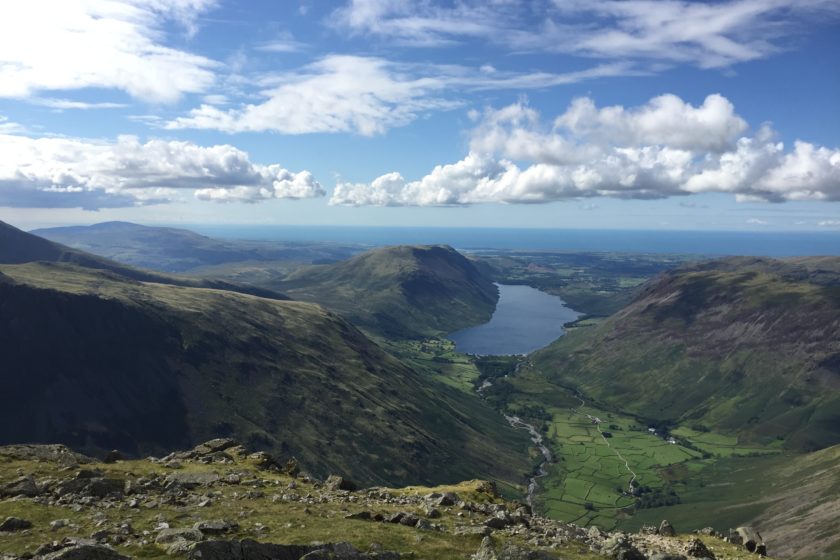
The last day is the shortest one with only 6.6 km between you and your car. Get back to Corridor Route and make your way to Styhead Tarn lake. The path doesn’t go all the way to the lake but takes you to the bottom of Great Gable (899m). The steep ascend will surely make you sweat but the reaching the top will be rewarding enough.
The most challenging part of the day will getting off the summit towards Windy Gap. It will require a bit of climbing but it’s nothing too hard and will put a smile on your face once you get down. From there it’s just a short walk to Green Gable (801m), the last peak of this trip. Now enjoy the lat bit of the route and just follow the path back to the car.