This 2 night wild camping hike was the reason we went all the way to Isle of Skye but unfortunately we weren´t able to finish it. The route as I initially planned it is 42.7 km long, starts in Portree and takes you to Kilmaluag via the Trotternish Ridge. There’s many peaks you’ll have to defend such as the Storr (719m), Hartaval (669m), Baca Ruadh (639m), Beinn Edra (611m) or Bioda Buidheand (466m). From there you can either take a bus (timetable here) or you can try hitchhiking. We did the latter and it took us about 5 minutes to get a lift back to Portree.
Below you can find the description of the first day along with the GPX coordinates for all three hiking days. Note that the first day´s GPX track is recorded by my watch while the remaining two days is the course as I planned it in Garmin Connect – I´m sure it´s accurate though. Most of the route is based on the well-known Skye Trail.
Day 1 (The Storr)
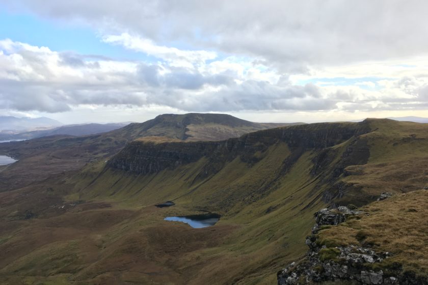
The route starts on the outskirt of Portree where you can find a few convenient spots to leave your car. Once you set off you´ll follow the road for about 2 km before you hit the moorland and start ascending towards A’ Chorra-Bheinn. In about a kilometre there´s going to be a fence and if you follow my course you´ll meet it exactly where it collapses so there´s no need to climb over it. For the next 5 km the track is going to be more or less the same – an ascending boggy moorland (with one more fence to climb over). However, as soon as you pass in between Beinn a’ Chearcaill and Ben Dearg the landscape changes and you´ll find yourself on a beautiful ridge that takes you towards the Storr. Keep on following it and eventually you’ll arrive to the famous Old Man of Storr. Once you get enough of this view make your way to the summit just above you – the Storr. It´s quite a steep walk but it will only take you about 10 or 15 minutes. Unfortunately for us, the peak was covered in a cloud so we couldn´t see a thing but perhaps you´ll be more lucky.
Now you´re minutes away from pitching your tent – just make your way down following our course to the very last point, which is a nice camping spot. The view from this spot is not as spectacular as I would have liked but it´s got some protection from the wind and there´s a clean stream right next to it. Last but not least, there´s no need to worry about the boggy floor – this spot has gravel thus the floor should be relatively dry.
The reason we decided to head back after the 1st night
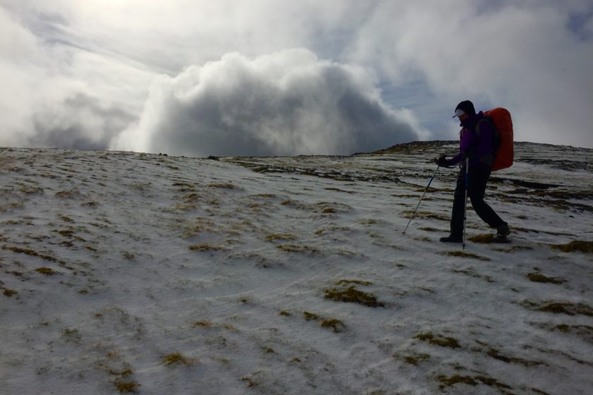
Long story short, the main reason was the weather. From the first minute we were getting regular showers of hail accompanied by strong winds coming from the West. The fact that my girlfriend´s boots started getting wet inside also didn´t help. Moreover, during the night the hail and wind got more intense and our tent was on the verge of resigning. Needless to say that we were expecting the first holes to appear any minute. Luckily, our amazing tent survived but the cherry on top was the snow that came towards the morning and within a few hours we got about two centimetres. At this point we were getting regular intervals of hailing and snowing with some gaps of peaceful weather. Although I would have waited for a bit more to see if the weather clears up I got over-voted by my girlfriend who demanded to take the shortest route down to the road as her boots still hadn´t dried up and our ´wardrobe´ didn´t really count with snow. As much as I hate failing I had to agree with a few of her points and we made our way back to Portree. Note that we did this hike in mid April.
Day 2 (Trotternish Ridge)
Day 3